Keep It SAFE
with SenseNet.
With Advanced Wildfire Detection Technologies
Why Wildfires Matter in the Squamish Region
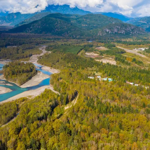
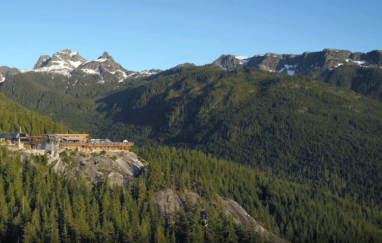
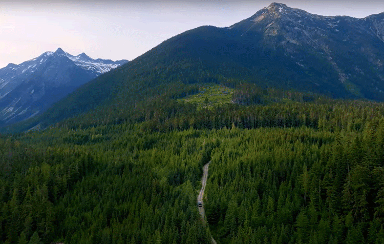
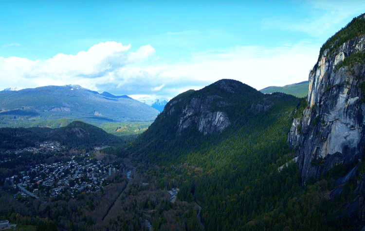
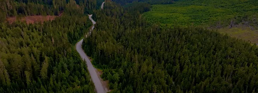
Located in the southwestern part of BC, is known for its breathtaking natural beauty, with vast forests, rugged mountains, and proximity to the Pacific coastline.
Also vulnerable to wildfires, which is a growing concern for local communities, the environment, and the economy.
Why Wildfires Are Disastrous in Squamish?


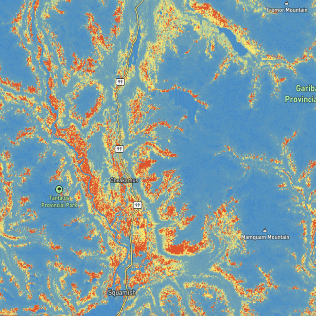
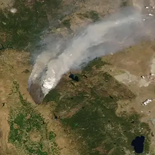
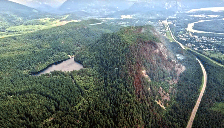
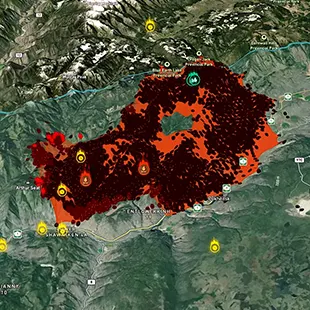
SenseNet Wildfire Risk Map Indicates High Fire Potential in Squamish
Top Signals High Fire Potential
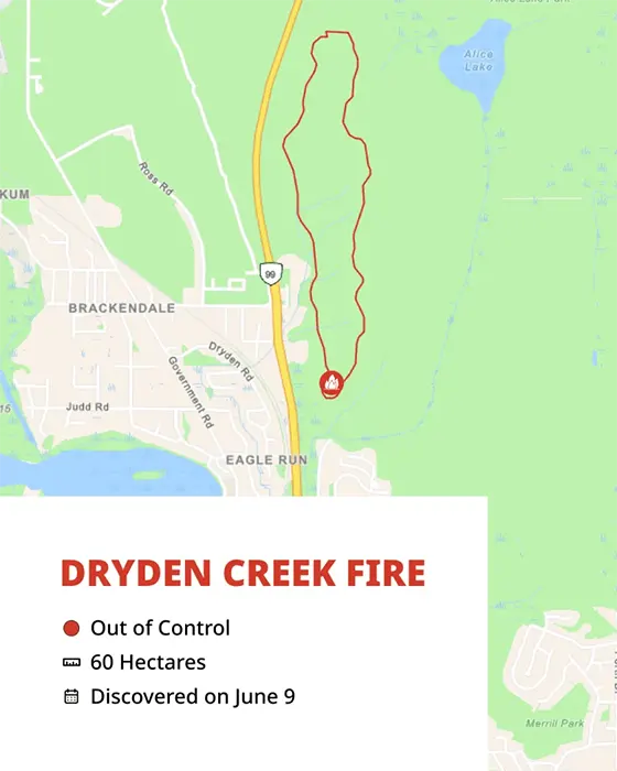
Depot Road
Dryden Creek
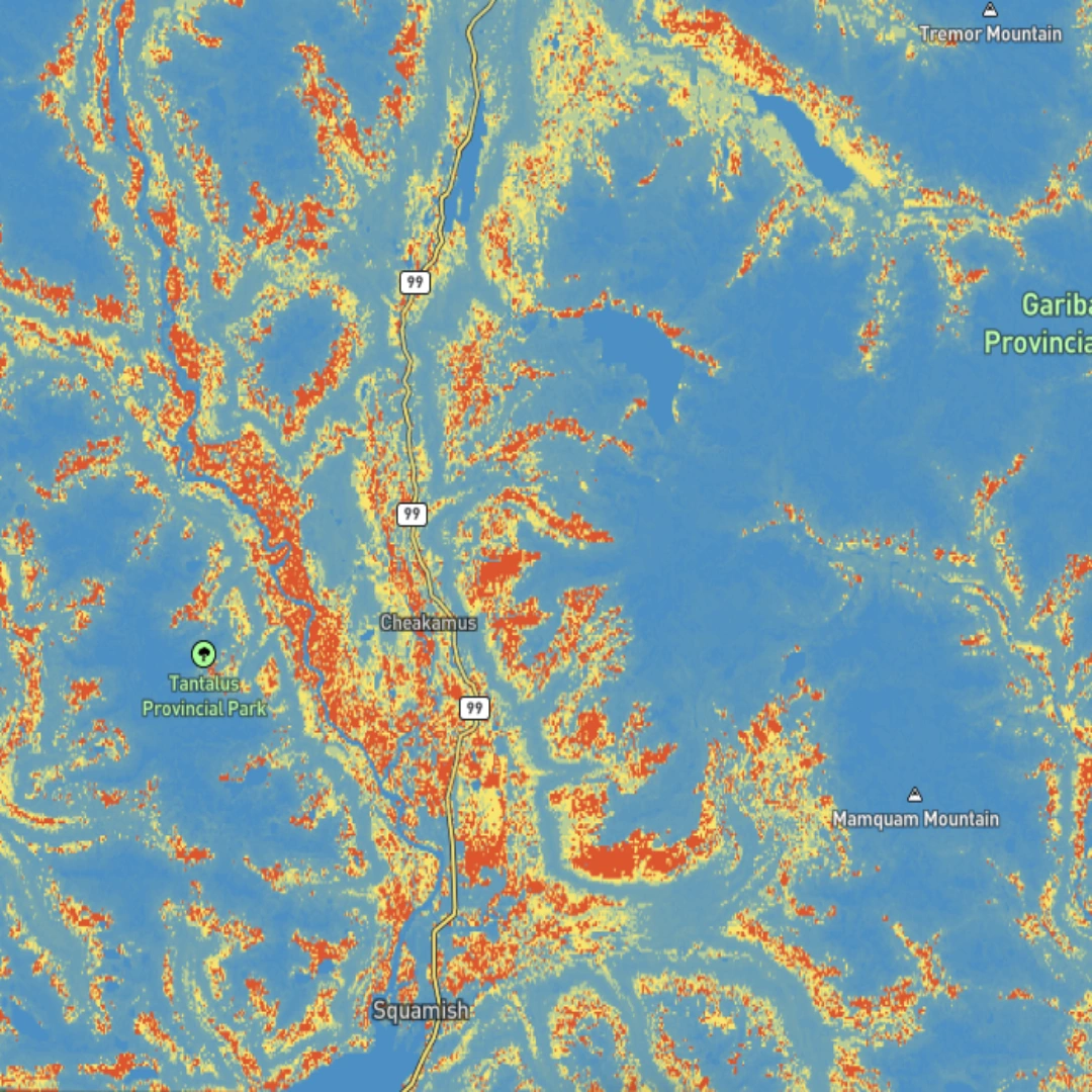
How Are Uncontrollable Wildfires Predicted?
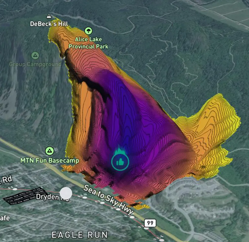
As depicted in SenseNet’s Wildfire Spread Model maps, the rate of fire growth and areas proximate to the wildfire are identified, where neglecting these factors can lead to fires becoming uncontrollable.
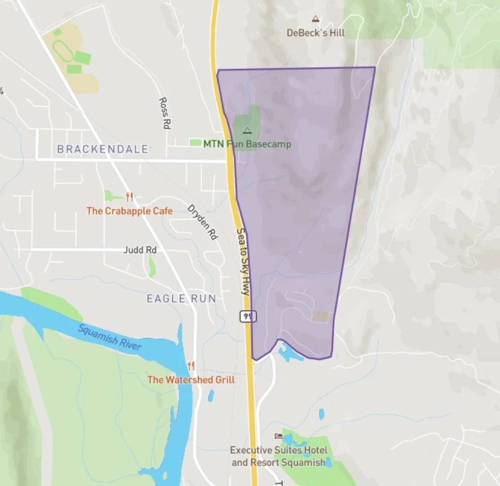
SenseNet Wildfire Risk Map Indicates High Fire Potential in Squamish
In the marked areas of the Squamish, wildfires rapidly escalate into crown fires.
Even the smallest flames are highly likely to necessitate evacuation.
The dense forests in the steep terrain of these areas substantiate these forecasts.
Are Wildfires a Recurring Threat in Squamish?
Yes, wildfires are a recurring threat in Squamish. The 10-year wildfire map reveals over 47 registered incidents, underscoring the need for strategic resource allocation to enhance preparedness and response effectiveness.
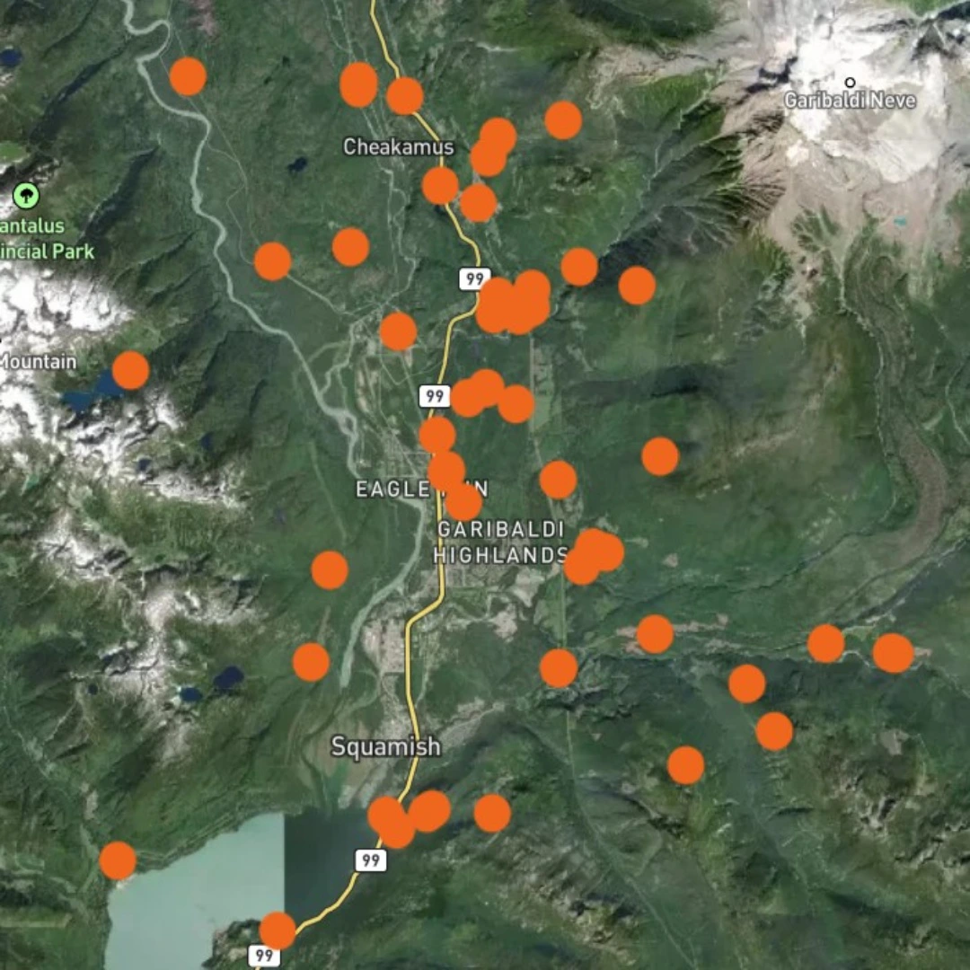
Let's review the areas marked on the Wildfire Highrisk map.
Recent Wildfire Examples

2017 Garibaldi Wildfire

2020 Magee Road Wildfire

2021 Thompson Okanagan Summer Wildfire

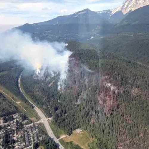
2025 Dryden Creek Wildfire
Potential Consequences of Wildfires in Squamish
Human and Psychological Impact
Infrastructure and Property Damage

Environmental
Consequences
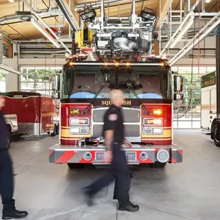
The Role of Authorities in Wildfire Prevention
- Protect valuable community resources
- Invest in prevention to reduce wildfire damages
- Implement predictive technology and proactive action to prevent fire escalation
Who is SenseNet?
SenseNet, a global pioneer in wildfire technology, harnesses AI, advanced sensors, cameras, satellites, and robust infrastructure to deliver unparalleled prediction, ultra-rapid detection, and intelligent decision-making.
Our innovative solutions empower communities and emergency teams, safeguarding lives and nature with precision and speed.
Now Imagine the Fire is Detected before It's Out of Control,
Before It's Too Late.
A camera sees it before anyone else.
Sensors smell what people can’t.
A satellite confirms the zone.
An alert is sent in minutes.
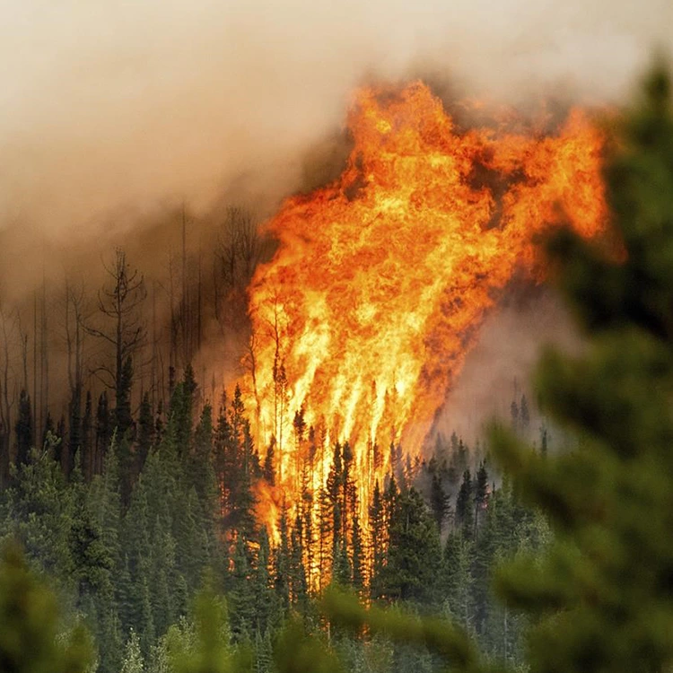
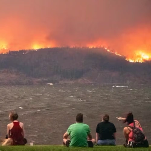
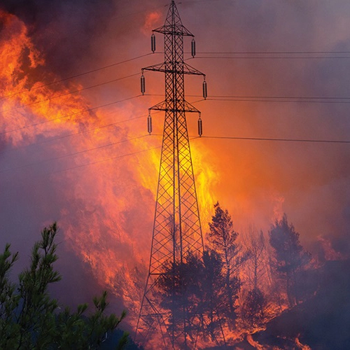
Wildfires Pollute the Air, Breathing Becomes a Struggle.
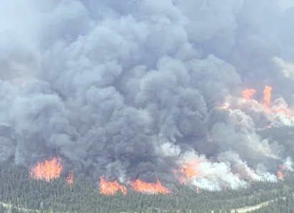
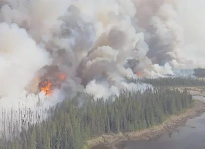
This Experience is Still Fresh in Our Minds.
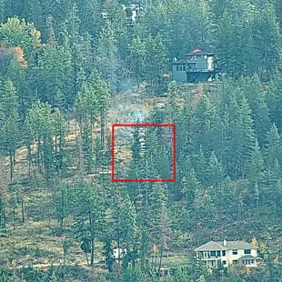
Dryden Creek Wildfire
Out of control for 10 days.
Reached 60 hectares.
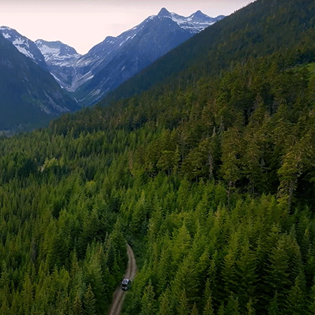
Wildfire Risk in Squamish: A Growing Concern
- Remote and mountainous terrain make fire response extremely difficult.
- Steep slopes delay firefighter access and containment.
- Wildfires in wilderness areas grow fast and spiral out of control.
- Communities are left vulnerable without real-time visibility or early warning.
The Fire Threat Is Close. But So Is the Power to Prevent It.
SenseNet’s Fire Spread Model Shows…
- Indicate the rate of fire growth.
- Predict at-risk areas around the wildfire’s epicenter in the coming hours.


What is the SenseNet's Solution?
- 24/7 Monitoring with AI-powered smoke detection cameras and gas sensors.
- High-Risk Area Maps using wildfire history, fire spread predictions, and satellite imagery.
- Automated Early Alerts—get notified instantly when smoke is detected, even from miles away.
- Fire Behavior & Growth Forecasting Tools for emergency planning and faster response.
- Smart Platform to manage all sensor and camera data in one place with automated reporting.
Protect What Matters Most
A Smart Coverage Plan for Squamish’s High-Risk Areas
SenseNet Stands with Squamish
to Prevent, Detect, and Predict Wildfire Pattern.
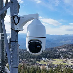
Smoke Detection
Camera


24/7 Wide Area Monitoring
Detects the smallest traces of smoke from 50 km away, providing a watchful eye over the landscape.
Gas Detection
Sensors
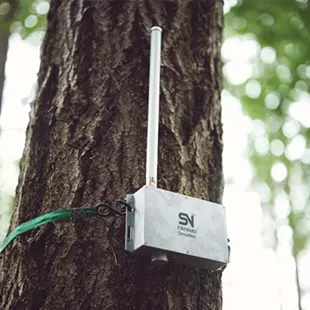
Detection with in 30 Seconds
Detects the earliest signs of wildfires, even when smoke and flames are not visible.
Satellite
Imaging
Fire Behaviour Analysis
Helps create daily wildfire risk maps, and to monitor and predict the spread of nearby fires.
Live Monitoring
Dashboard
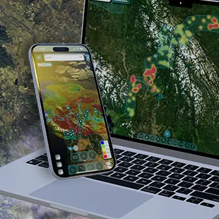
Wildfire Detection Platform
Live feeds and sensor alerts for fires and weather, supporting responders and communities.

Proudly Canadian. Already deployed on the globe.
Sensors & Cameras
Acres Protected Area
Detected Fires
Watch this Demo Camera in Action
This camera is currently showcasing the city of Vancouver for demonstration purposes.
Project Highlights
SenseNet, Tested and Verified by the Government of Canada, is already protecting 50 Communities Across the Country.
The Benefits of Partnering with SenseNet
Trusted by:
Frequently Asked Questions
This is the perfect setup to start feeling safe in this fire season:
40
2